The right tool for the job
Sustainable land management practices are key to ensuring future generations of production, but measuring success can be a challenge.
In 2020, the Queensland Department of Primary Industries (formerly Department of Agriculture and Fisheries) launched the Land Condition Assessment Tool (LCAT) to provide northern beef producers and the wider industry with a standardised method to collect land resource data and generate a suite of meaningful results.
As use of the tool increases, so too does its impact on the Australian Beef Sustainability Framework (ABSF) themes, including environmental stewardship, and people and the community.
Environmental stewardship
The LCAT determines land condition by considering a set of long-term indicators (the assessment inputs), including pasture composition, ground cover, soil erosion, pest plants, and understory and overstory densities.
LCAT developer Robert Hassett from the Queensland Department of Primary Industries explained that the program can be calibrated to calculate multiple results related to specific outcomes.
“On completion of an assessment, the tool displays 15 different results, including ABCD grazing land condition, indicative pasture biomass, fire potential, erosion risk and landscape stability,” he said.
The ABCD land condition framework categorises land condition from A (Good) to D (Very Poor).
“It’s feasible for LCAT to have even more results developed for broader applications or purposes.
“The calibration values – including those of pasture species – and the calculated results are based on scientific consensus,” Robert said.
Supporting decisions
As well as assessing current land condition, Robert said the tool is just as useful in assisting decision making or monitoring change over time.
“For example, there’s a result in the tool called ‘pasture deficit’, which triggers when the calculated indicative pasture biomass result (based on a simple relational table of certain inputs) is below 1,000 kilograms per hectare.
“It could serve as a reminder that you’re getting low on feed and need to look at moving stock to protect the pasture and ground cover. Or, you can use it for monitoring changes in things such as pest plants and their densities, or for documenting changing shrub and tree densities,” Robert said.

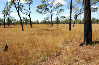
Caption: The LCAT helps to monitor and assess land condition,and what it means.
Since launching the tool, other states have become interested in utilising the technology.
“There’s been a huge interest from around Australia. At the moment it’s calibrated (using Queensland-based scientific consensus) to work in northern Australia, so it could be used in the Northern Territory and Western Australia almost immediately,” Robert said.
Where other states or regions ‘value’ pasture species differently (which could possibly generate an unexpected result), feedback and a simple modification can resolve this. This is part of ongoing improvement and development of the tool.
While including southern states would require further development of the tool, Robert said it was possible, but will require building a set of agreed pasture species and calibration values relevant to a state or region.
Indication of progress
Importantly, the LCAT results should be used to indicate progress, rather than any final outcomes.
“The land condition result reflects the condition at a point in time. It isn’t about attribution to current management, past management, or climate,” he said.
“It’s just a snapshot of the land condition in that moment from which change can be monitored in relation to changed management practices.”
Robert designed the app-based tool with landholders in mind, accessibility being the priority.
While the app was originally only available for licensed groups, the newest release will allow anyone to download the app to their phone or computer.
“Previously, other frameworks had been used which didn’t collect data or were overly scientific and difficult to use,” Robert said.
“The LCAT is an easy-to-use way of documenting the natural resources on your property and monitoring those changes over time.”
More information
Contact
Jacob Betros – Project Manager, Sustainability Credentials
Resources